- Drivetrain(10)
- Audio on the board(38)
- Safe-Skeg(21)
- Clothing and accessories(2)
- Heating and air conditioning(15)
- Anodes(68)
- Boat maintenance(4)
- Galley(21)
- Installation water and sanitary(625)
- Ventilation(27)
- Control system(37)
- Fuel installation(44)
- Exhaust installation(2)
- On-board accessories(11)
- Anchors and accessories(8)
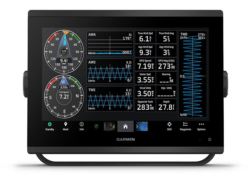
- Navigation(29)
- Binoculars(1)
- Plotters(14)
- Compasses(11)
- Tansducers(1)
- Lighting(80)
- Electrical installation(150)
- Yacht chemistry(1)
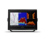
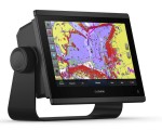
GPSMAP 723 Garmin 010-02365-00


Regular price:
product unavailable
 Description
GPSMAP 723 Garmin 010-02365-00
Non-sonar with Worldwide Basemap.
- SKU: 010-02365-00
- Easily integrate with more engines.
- Connect to compatible third-party devices with OneHelm™ digital switching.
- Easily build your marine system using the best of network connectivity.
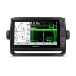
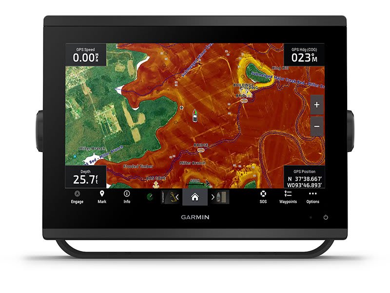
- Navigate any waters with preloaded mapping and coastal charts.
- See below your boat with built-in sonar capabilities.
- Manage your marine experience from nearly anywhere.
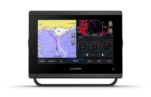
With its sleek design, powerful processing and upgraded IPS display, this advanced 7” chartplotter integrates seamlessly into your Garmin marine system.
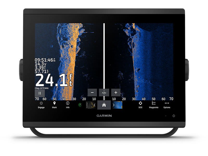
ULTRA HIGH-DEFINITION SCANNING SONAR
Get built-in Ultra High-Definition SideVü and ClearVü scanning sonars with vivid, high-contrast color palettes to help distinguish fish from structure. GPSMAP® X3 series also supports 1 kW CHIRP traditional sonar capabilities.
PANOPTIX™ SONAR SUPPORT
Pair with Panoptix or LiveScope™ easy-to-interpret live sonar (transducer required, sold separately) to see all around your boat in real time.
FASTER, SHARPER, SMARTER
With its added processing power and new slimline design featuring edge-to-edge glass and a smaller unit footprint, it’s easy to retrofit this plotter in a wider range of dash configurations.
IMPROVED DISPLAY OPTICS
New higher-resolution IPS displays for 9” and 12” plotters offer improved sunlight readability and visibility from any angle, with 50% more pixels than previous-generation 9” GPSMAP devices.
PRELOADED MAPPING
Experience unparalleled coverage and detail with preloaded BlueChart® g3 coastal charts and LakeVü g3 inland maps featuring integrated Garmin and Navionics® content and Auto Guidance technology.
OPTIONAL CHARTS AND MAPS
Bring a fresh new look and feel to your chartplotter with optional Garmin Navionics+™ or premium Garmin Navionics Vision+™ cartography featuring integrated coastal/inland content, access to daily updates, Auto Guidance+™ technology and more.
OPTIONAL CHARTS AND MAPS
Bring a fresh new look and feel to your chartplotter with optional Garmin Navionics+™ or premium Garmin Navionics Vision+™ cartography featuring integrated coastal/inland content, access to daily updates, Auto Guidance+™ technology and more.
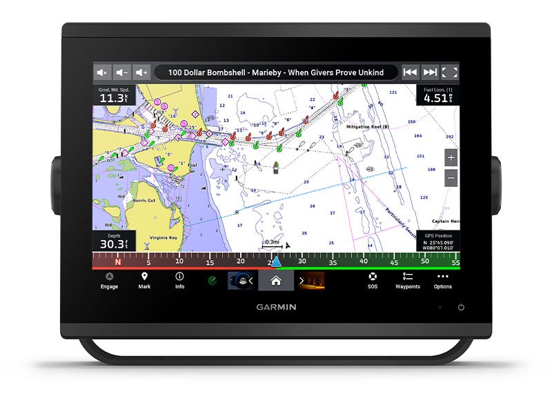
GARMIN MARINE NETWORK
If you have multiple compatible Garmin devices on your boat, you can share information — such as maps, user data, radar and IP camera video — among them.
NMEA 2000® AND NMEA 0183 NETWORKS
Connect to compatible autopilots, digital switching, weather, Fusion-Link™ audio system, media, VHF, AIS and more from one screen.
ACTIVECAPTAIN® APP
Built-in Wi-Fi® connectivity pairs with the free all-in-one mobile app for access to the OneChart™ feature, smart notifications, software updates, Helm, Garmin Quickdraw™ Community data and more.
INTEGRATED ANT® TECHNOLOGY
Connect with some of your favorite devices, such as quatix® marine watches, gWind™ Wireless 2 transducers, GNX™ Wind marine instruments and wireless remote controls.
J1939 CONNECTIVITY
Now you can connect your chartplotter to different kinds of engines, including select Yamaha engines.
ONEHELM FEATURE
This feature brings together all the operations and capabilities of select third-party devices, such as EmpirBus™ digital switching, on one screen.
Specification:
- SKU: 010-02365-00
| DIMENSION | 7.6" x 5.5" x 2.9" (19.2 x 14.0 x 7.4 cm) |
|---|---|
| TOUCHSCREEN | yes |
| INPUT | Touchscreen |
| DISPLAY SIZE | 6.1" x 3.5"; 7.0" diagonal (15.4 x 9.1 cm; 17.8 cm diagonal) |
| DISPLAY RESOLUTION | 1024 x 600 pixels |
| DISPLAY TYPE | WSVGA |
| WEIGHT |
2.8 lbs (1.3 kg) |
| WATERPROOF |
IPX7 |
| MOUNTING OPTIONS | Bail, flush or flat (Garmin does not offer any hardware or accessories for a flat-mount installation. Professional tools and knowledge is required.) |
Maps & Memory |
|
| ACCEPTS DATA CARDS |
2 microSD cards (back of unit) |
|---|---|
| WAYPOINTS |
5000 |
| TRACK POINTS | 50,000 |
| TRACKS | 50 saved tracks |
| NAVIGATION ROUTES | 100 |
Sensors |
|
| HAS BUILT-IN RECEIVER | |
|---|---|
| RECEIVER |
10 Hz |
| NMEA 2000 COMPATIBLE | yes |
| NMEA 0183 COMPATIBLE | yes |
| GPS | yes |
| GLONASS | yes |
| GALILEO | yes |
| SUPPORTS WAAS | yes |
Built-in Maps |
|
| BUILT-IN AUTO GUIDANCE | yes |
|---|---|
| BLUECHART (COASTAL) | yes |
| LAKEVU (INLAND) | yes |
| (SOUNDER) TIDE TABLES | yes |
Optional Map Support |
|
| LAKEVÜ G3 | yes |
|---|---|
| LAKEVÜ G3 ULTRA | yes |
| GARMIN NAVIONICS+™ | yes |
| GARMIN NAVIONICS VISION+™ | yes |
| (SOUNDER) TOPO | yes |
| STANDARD MAPPING | yes |
| GARMIN QUICKDRAW CONTOURS | yes |
| RASTER CHART SUPPORT | yes |
Chartplotter Features |
|
| SMART MODE COMPATIBLE | yes |
|---|---|
| AIS | yes |
| DSC | yes |
| SUPPORTS FUSION-LINK™ COMPATIBLE RADIOS | yes |
| GSD BLACK BOX SONAR SUPPORT | yes |
| GCV BLACK BOX SONAR SUPPORT | yes |
| ACTIVECAPTAIN® COMPATIBLE |
yes |
| GRID (GARMIN REMOTE INPUT DEVICE) COMPATIBLE | yes |
| WIRELESS REMOTE COMPATIBLE | yes |
| SAILING FEATURES | yes |
| SPOKEN AUDIO ALERTS | yes |
| ONEHELM SUPPORT | yes |
Sonar Features & Specifications |
|
| DISPLAYS SONAR | V |
|---|---|
| TRADITIONAL SONAR (DUAL FREQUENCY/BEAM) | yes (with GCV™ black box, sold separately) |
| CLEARVÜ | yes (with GCV™ black box, sold separately) |
| (SOUNDER) SIDEVÜ | yes (with GCV™ black box, sold separately) |
| PANOPTIX™ SONAR | V |
| LIVESCOPE | V |
Connections |
|
| NMEA 2000 PORTS | 1 |
|---|---|
| CONNECTIONS NMEA0183 INPUT PORTS |
1 |
| NMEA 0183 INPUT (TX) PORTS | 1 |
| VIDEO INPUT PORTS |
1 (BNC composite) |
| J1939 PORTS | 1 |
| GARMIN MARINE NETWORK PORTS |
1 |
| USB PORTS | V |
| BNC EXTERNAL GPS ANTENNA PORT | V |
| BLUETOOTH® CALLING | V |
| ANT+ (CONNECTIVITY) | V |
| GARMIN WI-FI NETWORK (LOCAL CONNECTION) | V |
Electrical Features |
|
| POWER INPUT | 10 to 32 Vdc |
|---|---|
| TYPICAL CURRENT DRAW AT 12 VDC | 1.08 A |
| MAXIMUM CURRENT DRAW AT 12 VDC | 1.45 A |
| MAXIMUM POWER USAGE AT 10 VDC | 17.6W |
Files to download:
Shipping costs
The price does not include any possible payment costs
Related products
GPSMAP 923 Garmin 010-02366-00
GPSMAP 8416xsv Garmin 010-02093-02
GPSMAP 8412xsv Garmin 010-02092-02
GPSMAP 723xsv Garmin 010-02365-02
ECHOMAP UHD 92sv Garmin 010-02341-00